The question "what is the best hiking app?" is unanswerable without context because different apps solve different problems. AllTrails helps you find a trail. Gaia GPS helps you not get lost on it. Strava logs the effort. GoVenture organises the whole trip. Most experienced hikers use two of these together because no single app does everything well.
The short version
AllTrails for trail discovery. Gaia GPS for hardcore navigation and layered topo maps. GoVenture for multi-day trip logistics with gear, itineraries and group coordination. Komoot if you are in Europe. onX if you hunt or go off-trail. Many people run two apps and move GPX files between them.
Full disclosure: We make GoVenture, so read our take on it accordingly. Our assessments of other apps are opinions based on publicly available information and our own use as of August 2026 — features, tiers and pricing change often, so confirm details on each app's own site. If you spot something we got wrong, email us and we will correct it.
Four categories of hiking app
Most confusion comes from treating all hiking apps as interchangeable when they are built for fundamentally different use cases. It helps to think in categories:
- Discovery apps: Find trails, read reviews, see photos, filter by difficulty or distance. AllTrails dominates here.
- Navigation apps: Load GPX routes, display layered topo maps offline, record GPS tracks, navigate with waypoints. Gaia GPS, onX Backcountry and Komoot excel here.
- Fitness apps: Log workouts, track calories, compare efforts, follow or compete with others. Strava owns this space.
- Logistics and planning apps: Build day-by-day itineraries, manage gear lists with weights, coordinate group packing, store permits, plan resupply — for any outdoor trip, not only hiking. GoVenture is purpose-built for this.
You probably need one app from the first or second category, and maybe one from the fourth if you do multi-day trips or go with groups. The third category — fitness tracking — is optional unless training or social features matter to you.
AllTrails: best-in-class trail discovery
AllTrails is the dominant trail discovery platform, and for good reason. It has what is widely regarded as the largest curated database of hiking trails, with user-submitted reviews, photos, difficulty ratings and recent trip reports. If you want to know whether a trail is muddy this week, whether the wildflowers are out, or how hard it really is, AllTrails is where you look.
The search and filter interface is intuitive — you can filter by distance, elevation gain, difficulty, route type (loop, out-and-back, point-to-point), dog-friendly, kid-friendly, wheelchair accessible, and more. The community is massive, so even obscure trails often have recent reviews.
AllTrails also includes basic GPS tracking and offline map downloads (with the paid tier), but these features are not as advanced as dedicated navigation apps. The map layers are limited, GPX import and export is functional but basic, and the route planning tools are minimal. If you only hike marked trails and mostly do day trips, AllTrails may be all you need. If you go off-trail, plan multi-day routes, or want detailed topo layers, you will hit its limits.
Where AllTrails is weaker
- No gear list or packing features.
- No day-by-day itinerary builder for multi-day trips.
- No group trip coordination or shared packing lists.
- Limited map layers compared to Gaia or onX.
- Route planning is basic — you cannot easily create custom routes by drawing or stitching segments.
Best for: Day hikers, beginners, anyone who wants to discover new trails with social proof (reviews and photos). Weakest for multi-day logistics and advanced navigation.
Gaia GPS: best-in-class navigation and offline topo maps
Gaia GPS is the tool of choice for serious backcountry users. It offers one of the widest selections of map layers of any outdoor app — USGS topo, satellite imagery, OpenStreetMap, international topo sources, and specialised layers such as weather and wildfire data. You can overlay multiple layers and adjust transparency, which is invaluable for route planning in complex terrain.
Offline map downloads are robust and cover the entire world. GPX import and export work seamlessly, and you can edit routes on the phone or on the web interface. Waypoint management is detailed, and the recording features are comprehensive with customisable data fields. If you go off-trail, navigate in unfamiliar international terrain, or need to cross-check multiple map sources for accuracy, Gaia is the right tool.
The trade-off is a steep learning curve. The interface has a lot of options, and new users often find it overwhelming compared to the simplicity of AllTrails. Gaia also has no trail discovery features — there is no review database, no photos, no community ratings. You bring your own route, or you find one elsewhere and import the GPX.
Where Gaia GPS is weaker
- No curated trail database — you cannot search "easy hikes near me" and get a list with reviews.
- No gear list, packing features or trip logistics tools.
- No group coordination or shared packing lists.
- Steeper learning curve than AllTrails or GoVenture.
- Most of the map layers and offline features require a subscription.
Best for: Experienced hikers, mountaineers, off-trail navigators, international travellers, anyone who needs detailed layered maps and advanced GPX tools. Weakest for beginners and for trip logistics beyond the route itself.
onX Backcountry: land ownership and off-trail navigation
onX Backcountry (formerly known for hunting maps) shows public and private land boundaries overlaid on topo maps. If you hunt, hike or camp in areas where land ownership is complex — national forest adjacent to private ranch land, BLM mixed with state trust land — onX tells you where you can legally go. This is its killer feature, and few apps come close to matching it.
The mapping and offline capabilities are strong, comparable to Gaia. The interface is clean, and the 3D topo view is excellent for visualising terrain. GPX import and waypoint management are solid. If you spend time off-trail in the western United States or in hunting zones, onX is often worth running alongside another app purely for the land ownership layer.
Where onX is weaker
- No trail discovery or review database.
- Land ownership data is most detailed in the United States — international coverage is limited.
- No gear, itinerary or group coordination features.
- Less map layer variety than Gaia GPS.
Best for: Hunters, off-trail hikers, anyone navigating mixed public/private land in the US. Weakest for marked trails, international use, and trip logistics.
Strava: fitness tracking, not trip planning
Strava is a fitness platform, not a hiking app, but many hikers use it to log workouts and compare efforts. It records GPS tracks, calculates calories and pace, syncs with heart rate monitors and smartwatches, and provides a social feed where you can follow friends and give kudos. If you care about training metrics, segment leaderboards, or social accountability, Strava is excellent.
Strava has also grown navigation features over the years — subscribers get a route builder, offline maps and waypoints, and its heatmap-informed route suggestions are genuinely useful. But those tools are fitness-oriented rather than trip-oriented: there are no gear lists, no itineraries, no group packing, nothing resembling multi-day trip logistics, and its maps are not built for backcountry terrain analysis the way Gaia's or onX's are. Many people use Strava in parallel with another app — Gaia or AllTrails for the hike, Strava to record the effort.
Best for: Fitness-focused hikers, runners and cyclists who want training data and social features. Not built for trip planning or logistics.
Komoot: route planning for Europe with strong turn-by-turn
Komoot is popular in Europe for hiking and cycling route planning. It offers turn-by-turn voice navigation, community-recommended "highlights" (viewpoints, rest stops), and a route planner that suggests paths based on your activity type and fitness level. The interface is polished, and the offline map downloads are reliable.
Map coverage and trail data are strongest in Europe, though North American coverage has improved. If you hike or bike in Germany, Austria, Switzerland, the UK or Scandinavia, Komoot is often better than AllTrails for route discovery because the local community is larger. In the United States, AllTrails still has more trails and reviews.
Where Komoot is weaker
- Trail database is less comprehensive than AllTrails in North America.
- No gear, itinerary or group coordination features.
- Map layers are limited compared to Gaia GPS.
Best for: Hikers and cyclists in Europe who want turn-by-turn navigation and community route recommendations. Less useful in North America and for multi-day trip logistics.
GoVenture: trip logistics in one place
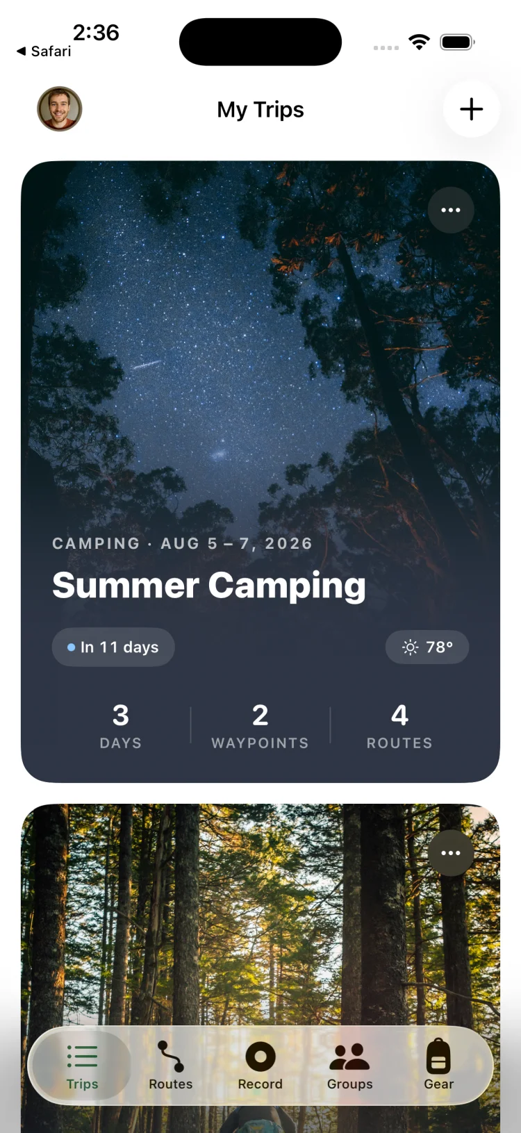
GoVenture is built for the part of the trip that happens before you start hiking: planning the itinerary, building the gear list, coordinating with the group, organising permits and resupply. It is a trip organiser first: it assumes you already know roughly where you are going, or that you will import a GPX route from another source.
GoVenture does have a community side — users can publish routes, and shared routes are matched into community trails with photos, star ratings and reviews. But we will be straight with you: this is a young, growing library built from what our users share, not a comprehensive curated database. It is nowhere near the coverage of AllTrails, and it is not trying to be. If discovering new trails is your main goal, start with AllTrails; if you find a GoVenture community route in your area, it is a bonus.
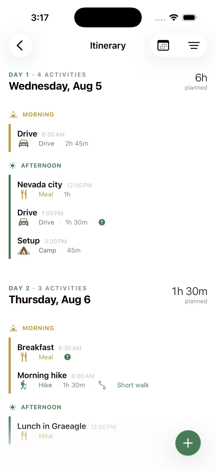
A trip in GoVenture holds the route (drawn or imported GPX), the day-by-day itinerary with activities and start times, the gear list with weights and categories, offline map downloads, waypoints, weather forecast for the trip dates, and permit information. If you are going with other people, you can invite them to the trip and assign gear items to specific people, so everyone knows who is bringing the stove and nobody packs two water filters.
The gear system is particularly strong. You build a permanent inventory with weights, group items into reusable "Quick Kits" (sleep system, kitchen, first aid), and add them to trips in one tap. The app totals your pack weight automatically, so you know what you are carrying before you carry it. This is the feature set you would otherwise cobble together from a spreadsheet, Notes, and a group text thread.
Where GoVenture is weaker
- Limited trail discovery. Community routes and trails exist, but the library is small compared to AllTrails or Komoot. If you do not know where you want to go, start there, then bring the GPX into GoVenture.
- Map layers are basic — OpenStreetMap topo and satellite. No USGS quads or specialised layers like Gaia offers.
- Recording and live navigation are functional but not as feature-rich as Gaia or onX for hardcore off-trail use.
Not just hiking
One difference worth understanding: every other app in this comparison is built around trails or tracks. AllTrails is a trail database, Gaia and onX are trail and terrain navigation, Komoot routes you along paths, and Strava logs activities (including rides and swims) after the fact. That is their strength — and their boundary. None of them is built to organise a trip that does not follow a trail.
GoVenture's trip model is activity-agnostic. An itinerary, a gear list with group assignments, permits and bookings, offline maps, and a float plan work the same whether the trip is a backpacking loop, a river rafting weekend, a group scuba trip, a ski trip, a climbing objective or an overlanding route. That is the design: the app is organised around the trip, not the trail, because the logistics problem — who is coming, who is bringing what, where you are staying, when you are due back — is the same for every outdoor activity. Float plans, a safety practice borrowed from boating, are built in for the same reason.
Best for: Weekend backpackers, group trip organisers, and anyone planning multi-day outdoor trips — hiking or otherwise — with gear, itineraries and logistics. Weakest for trail discovery and advanced off-trail navigation.
GoVenture is free for trips, itineraries, gear lists and group planning. Pro unlocks route drawing, unlimited gear lists, gear weight tracking, offline map downloads and extra map styles. See the full details at how to plan a backpacking trip.
Capability comparison table
This table compares the six apps across the features that matter for trip planning and navigation. A "Yes" means the feature is present and functional; "Limited" means it exists but is basic; "No" means it is absent or unusable.
| Capability | AllTrails | Gaia GPS | onX | Strava | Komoot | GoVenture |
|---|---|---|---|---|---|---|
| Trail discovery with reviews | Excellent | No | No | No | Good (Europe) | Limited |
| Offline topo maps | Yes | Excellent | Excellent | Yes | Yes | Yes |
| Multiple map layers | Limited | Excellent | Good | No | Limited | Limited |
| GPX import/export | Yes | Excellent | Yes | Yes | Yes | Yes |
| Day-by-day itinerary | No | No | No | No | No | Yes |
| Gear list with weights | No | No | No | No | No | Yes |
| Group gear assignment | No | No | No | No | No | Yes |
| Permits tracking | No | No | No | No | No | Yes |
| GPS recording | Yes | Excellent | Yes | Excellent | Yes | Yes |
| Land ownership overlay | No | Limited | Excellent | No | No | No |
| Fitness/workout tracking | Basic | Basic | Basic | Excellent | Good | Basic |
| Price model | Free + sub | Free + sub | Subscription | Free + sub | Free + sub | Free + sub |
Ratings are our opinion, based on publicly available information and our own use as of August 2026. Features and tiers change — check each app's website for current details. "Limited" for GoVenture's trail discovery reflects a growing community route library rather than a curated database.
Why no single app dominates
Trail discovery requires a massive curated database and community engagement. Advanced navigation requires deep mapping partnerships and offline tile infrastructure. Trip logistics require workflow design for itineraries and gear. Fitness tracking requires integrations with wearables and social platforms. Building all four well is prohibitively expensive, so most companies pick one or two and do them excellently. That is why experienced users run multiple apps.
Which app should you pick? Decision by user type
Here is the honest recommendation based on what kind of hiker you are and what you actually do:
You are a day hiker who sticks to marked trails
Pick AllTrails. You need trail discovery with reviews and photos more than you need advanced navigation. The basic GPS tracking and offline maps in AllTrails are enough for marked trails. You do not need gear lists or multi-day itineraries.
You do weekend backpacking trips, solo or with one or two people
Pick GoVenture if you want the full trip organised in one place — itinerary, gear with weights, permits, offline maps. Use AllTrails or local guidebooks to find the route, export the GPX, and import it into GoVenture.
Pick Gaia GPS if you care more about layered topo maps and advanced navigation than about itinerary and gear organisation. You will probably still end up using a spreadsheet or Notes for the packing list.
You organise group trips with four or more people
Pick GoVenture. The shared packing list with gear assignment to specific people eliminates the "who's bringing the stove?" text thread. Everyone in the group sees the same itinerary, waypoints and offline map.
You go off-trail, mountaineer, or navigate complex terrain
Pick Gaia GPS. You need multiple map layers, advanced waypoint management, and detailed GPX tools. The learning curve is worth it. If you are in the US and land ownership matters, consider running onX alongside Gaia purely for the boundary overlay.
You are a thru-hiker or long-distance trekker
Pick Gaia GPS for navigation and offline maps. Consider GoVenture for resupply planning, itinerary and gear if you are doing a supported trek or a hike with planned town stops. Most thru-hikers also use Guthook (now FarOut) for trail-specific data and water reports, which is outside the scope of this comparison.
You hike or bike in Europe
Pick Komoot for route discovery and turn-by-turn navigation. The community and trail coverage are stronger than AllTrails in most European countries. Add Gaia if you need advanced map layers, or GoVenture if you need itinerary and gear planning for a multi-day trek.
You hunt, or you hike in mixed public/private land
Pick onX Backcountry for the land ownership layer, and use it alongside AllTrails (for trail discovery) or Gaia (for advanced maps). The land boundary data alone justifies the subscription if you spend time in complex ownership areas.
Your trips aren't only hiking — rafting, diving, ski trips, paddling
Pick GoVenture. It is the only app in this comparison whose trip model is not tied to trails. The itinerary, gear assignment, permits, float plan and group features work identically for a rafting weekend, a group dive trip or a ski trip. The trail-centric apps have no equivalent, because there is no trail to look up.
You care about fitness metrics, training and social features
Pick Strava for workout logging and the social feed. Run it in parallel with a navigation app — Gaia, AllTrails or GoVenture for the hike, Strava to log the effort and share with friends.
Try GoVenture for your next trip
Free on iPhone for trips, itineraries, gear lists, waypoints and group planning. Pro unlocks route drawing, unlimited gear lists, gear weight tracking, offline maps and extra map styles. Built for the logistics that most apps ignore.
Get GoVenture free →Frequently asked questions
What is the best app for planning a hiking trip?
It depends what you mean by planning. AllTrails is the best for discovering trails and reading reviews. Gaia GPS is the best for offline navigation and layered topo maps. GoVenture is the best for organising the logistics — itinerary, gear with weights, group packing lists, permits and offline maps in one trip. Many people use two apps: AllTrails to find the trail, then Gaia or GoVenture to navigate and manage the trip.
Is AllTrails better than Gaia GPS?
For trail discovery, yes — AllTrails has what is widely regarded as the biggest database of curated trails with reviews and photos. For offline navigation and serious backcountry mapping, no — Gaia GPS offers more map layers and more advanced GPX and route planning tools. AllTrails is easier to learn; Gaia is more powerful for experienced users. If you only do marked trails and want to know what other people thought, pick AllTrails. If you go off-trail or need detailed topo layers, pick Gaia.
What is the best free hiking app?
AllTrails has a generous free tier with trail discovery and basic GPS tracking. Gaia GPS has a free tier but reserves most map layers and offline downloads for subscribers. GoVenture is free for trips, itineraries, gear lists and group planning — Pro unlocks route drawing, unlimited gear lists, gear weight tracking, offline maps and extra map styles. For free trail discovery, pick AllTrails. For free trip planning with gear lists and itineraries, pick GoVenture.
Can I use two hiking apps together?
Yes, and many experienced hikers do. A common pairing is AllTrails for discovery and Gaia GPS for navigation, or AllTrails for the trail and GoVenture for the trip logistics. Most apps can import and export GPX files, so you can find a route in one app, export the GPX, and load it in another. You are not locked into one ecosystem. See the guide on how to import a GPX file on iPhone.
Can I use GoVenture for trips other than hiking?
Yes. GoVenture's trip model is activity-agnostic — the itinerary, gear lists with group assignment, permits, offline maps and float plans work the same for river rafting, group scuba trips, ski trips, climbing, paddling and overlanding as they do for hiking. The other apps in this comparison are built around trails, so they do not cover non-trail trips.